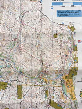
2017 Australian Adventure. An in depth look at the Australian Long Distance Orienteering Champs 2017 from Kiwi junior Georgia Skelton. Read her report below and check out the race map at the end, or jump across to route gadget for a larger scale version of the map.
The last two weeks in Australia have been full on for me racing in both orienteering and mountain bike orienteering. I really enjoyed the different terrain to NZ which required a range of skills that I don’t often use back at home.
The foot orienteering carnival was on a mix of maps from complex goldmine terrain to vague sloping contours. The Australian Long Champs, held at Hill End, in particular combined both of these making it a unique challenge. You had to know when to slow down and read the map detail and also when to boost to the control. Having raced already at Hill End on similar terrain I had a fair idea of what the course would be like and could prepare better what I was expecting to run on.
My W16 course started with a short leg straight from the start into a series of small dry streams and earth pillars. Control 1 required a rough compass bearing to check the exit direction to control 2 but I didn’t do this and exited too much to the right, floating up into an area of scattered trees. Luckily because of this big vegetation feature, I was able to relocate and navigate back to the control.
Legs 2-3 and 5-6 were the most interesting of the course. Going to control 3, I had a vague hill between me and the control, and there was the option to either contour around or go straight over. Given the lack of features, I knew I would have to stick to a bearing the whole way over. I chose to run straight over the top of the hill, sticking pretty much on the line. Dropping down into the control there was an obvious taped pit to the left of it and I sighted this from a long way off, confirming I was on track to hit the control.
Having nailed this leg it boosted my confidence for the rest of the course and I trusted my compass for the more vague legs and switched to contour reading for the tight detail later on, using all my orienteering ability to run a good, clean race.
Leg 5-6 crossed some vague areas then a complex stream complex leading down into the control. After having a good look at the leg, I decided to run the road. Even though it was quite far out, it was basically downhill then flat and had a really good attack point to lead me into the control. I knew I could just flat out run while planning the rest of the course. I boosted the road and used a stream leading me through the green into my control as an attack point. The rest of the controls were all in complex goldmine terrain to the finish, and so I slowed down a little to execute the legs I had planned while running to 6.
Overall I was really happy with my run and had used a lot of skills I had been practicing while racing on Australian terrain. Using my compass was something that I improved a lot, because in NZ I usually navigate using contours and features and practically never take bearings or use my compass to keep orientated.
At the start of the week I made a few errors on the Australian middle that could have been easily avoided by checking my direction with my compass. But as the week progressed I started to rely a lot more on the compass compared to the contours especially in the vague sloping terrain where it was very easy to go off line and end up a long way from the control.
Coming back to NZ with club nationals less than two weeks away I’m feeling a lot more confident having developed more skills in Aussie like compass work which I can use at nationals.